Monarch Crest Trail Mountain Bike
Trail Guide
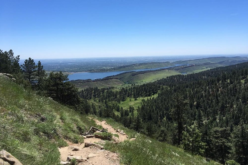
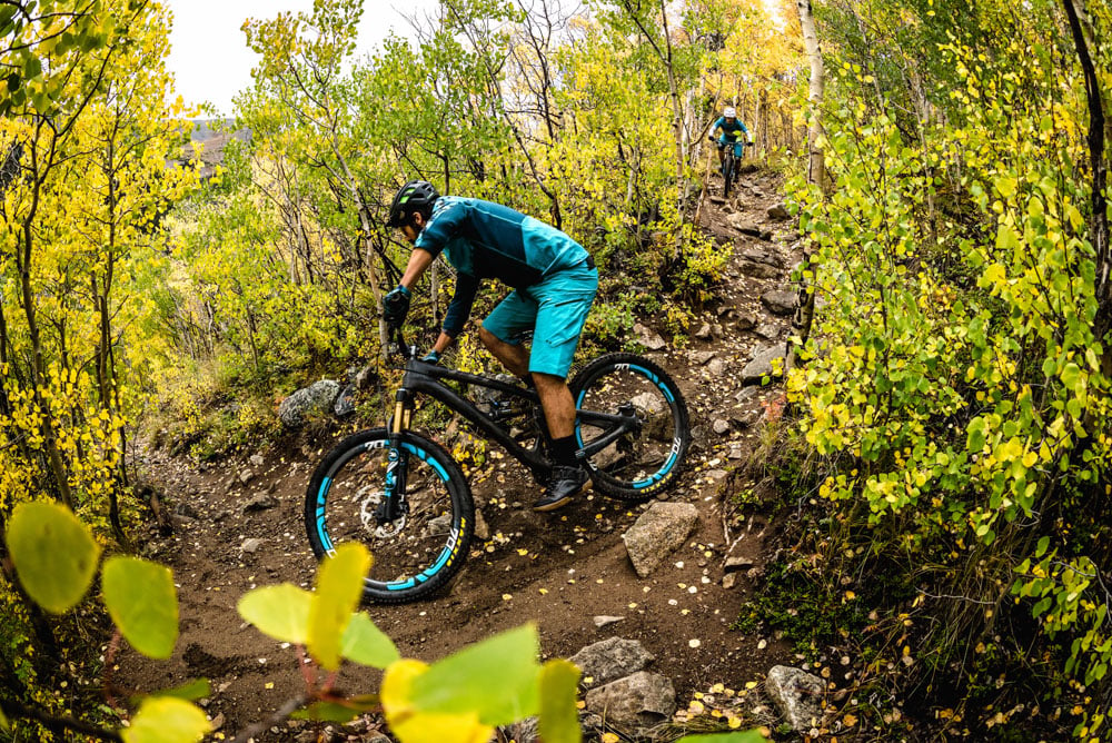
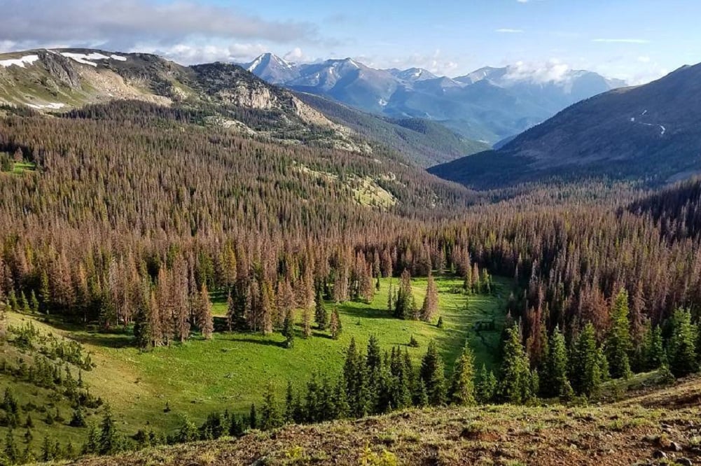
The beautiful high alpine riding and huge descents of the Monarch Crest Trail make it one of Colorado’s classic mountain bike trails. Rather than one trail, The Crest is really a collection of trails that descend from the summit of Monarch Pass to the towns of Poncha Springs and Salida. The Monarch Crest Trail itself rolls across open slopes and meadows near treeline before dropping into the woods. From the trail, there are options for different mileage and technicality of rides. The Monarch Crest Trail is almost always shuttled, starting at the pass and ending in town. Throughout the ride, there are great high-alpine views, smooth flowy sections, and also some technical bits.
One of the most popular routes winds a big 35 miles down, descending over 6,000’. Despite being a shuttle accessed ride, there is still some climbing on the Monarch Crest, with some punchy steep sections. The huge descent is what makes the trail one of the best mountain bike trails in Colorado though. There are a couple variations of the route that can be ridden, too. These trails split off of the Crest Trail to offer some shorter options, with really fun descents.
A couple companies offer paid mountain bike shuttles that can take the hassle out of riding this amazing piece of Colorado singletrack, Abolute Bikes in Salida, and the High Valley Bike Shuttle out of Poncha Springs.
| Total Trails | 10+ | Difficulty | Advanced |
| Total Distance | 40+ miles | Style | Cross County |

evo's Favorite Trails
Monarch Crest to Silver Creek to Rainbow
Advanced | 34.6 Miles | 2,281' Climb | 6,133' Descent
Get ready for an awesome adventure, with over 6,000’ vertical feet of descent from the top of Southern Colorado’s Monarch Pass. This is the classic Monarch Crest Trail ride, starting from the namesake trail and connecting down to Highway 285, it is the longest route, too. Stay on the Monarch Crest Trail as you pass by Fooses Creek and Green Creek, continuing briefly on the Colorado Trail, then heading left on the Silver Creek Trail. The Rainbow Trail rounds out the point to point ride, emptying out on US 285, or continuing all the way into Salida. While completing the whole ride is certainly an epic adventure, many riders may want to opt out of Rainbow and it’s demanding ups, downs, and technical sections, especially after the long descent from Monarch pass. For those not riding Rainbow, the Silver Creek lakes Road and Marshall Pass Road lead back to the highway.
Monarch Crest to Fooses Creek
Advanced| 11 Miles | 1,027' Climb | 2,756' Descent
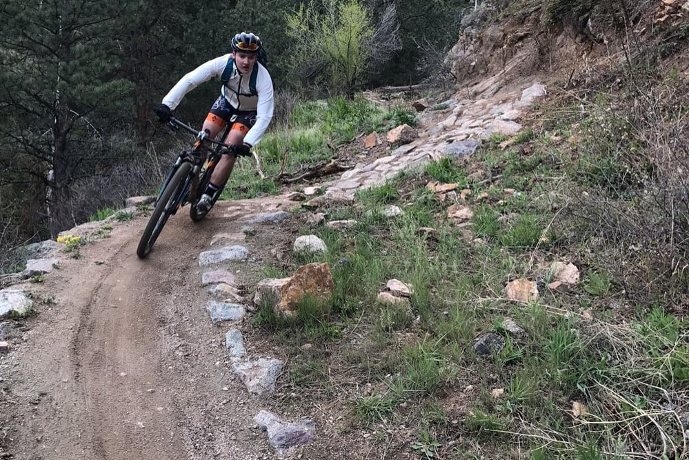
Fooses Creek is the first turn off of the Monarch Crest Trail, and one of the shorter loops in the area. The singletrack here is bumpy and technical, but also fast and fun. Your suspension will be working hard, and so will your body. The lower portion of Fooses Creek Trail gets more smooth and flowy, allowing for high speed fun. This section of trail is one of the best in the Monarch Crest area. This route loops back to Highway 50. It’s possible to shuttle all the way from town, or leave a car at the bottom of Fooses Creek Road. Monarch Crest to Green's Creek
Advanced | 14 Miles | 1,105' Climb | 3,822' Descent
The Monarch Crest Trail to Green’s Creek is another popular option, that is shorter and has less climbing. The trail is a bit more rough and technical, similar to Fooses Creek. This is one of the most fun descents at the Monarch Crest. Monarch Crest to Agate Creek
Advanced | 17 Miles | 2,006' Climb | 4,197' Descent
Agate Creek is similar to the other optional routes, with both smooth fast singletrack and rough technical terrain. Agate Creek Trail drops west off of the Monarch Crest Trail, instead of the others that drop east. There are a bunch of small creek crossings on the trail.
Our Favorite Mountain Bike Bags for the Monarch Crest
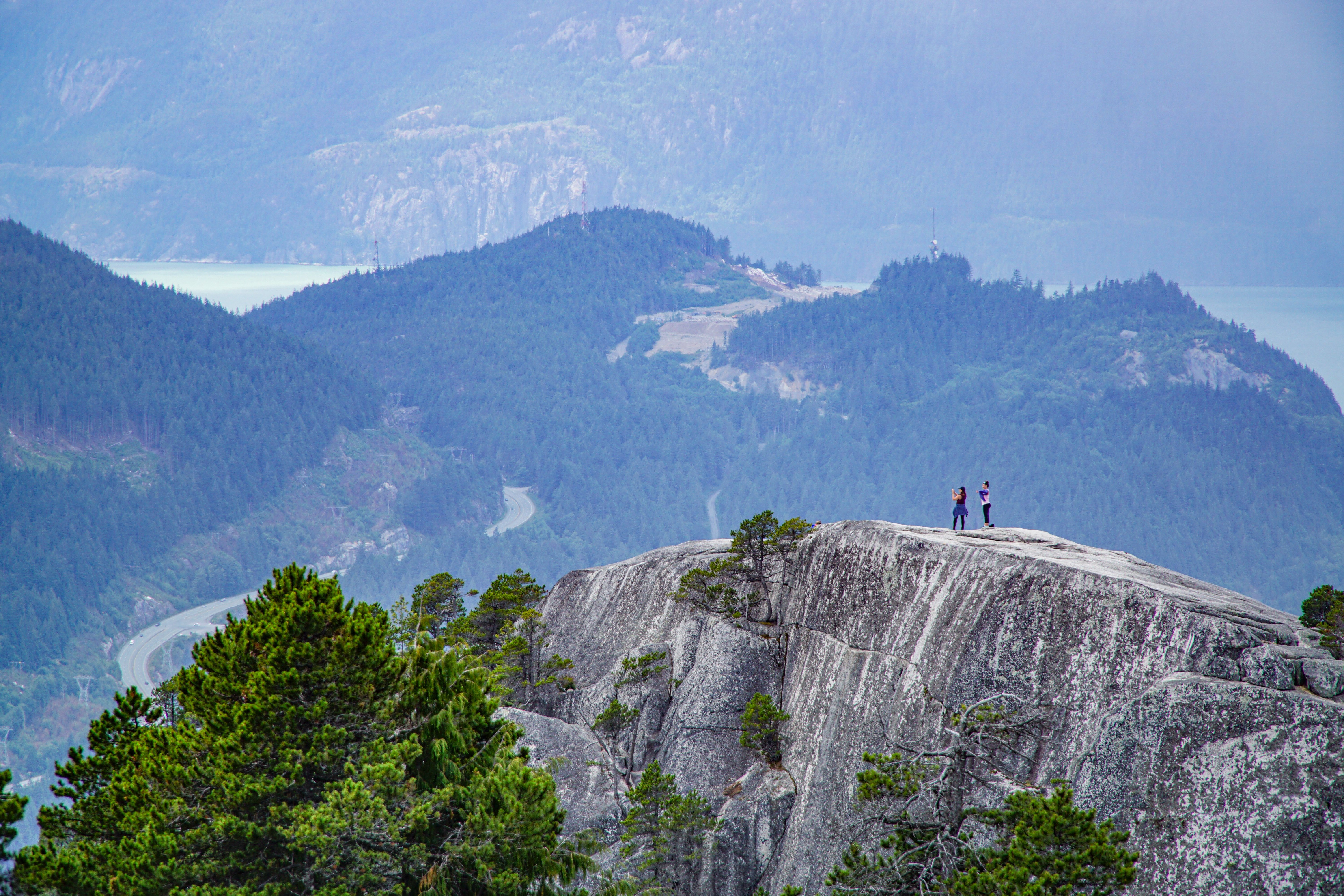
Monarch Pass and the Monarch Crest Trails are located in Southern Colorado between the towns of Salida to the east and Gunnison to the west. From Salida, it is a 30 minute dive to the mountain bike trails at the summit of the pass. For shuttling riders, there is parking available at Fooses Creek, Agate Creek, and Green’s Creek, although some will opt to ride on the highway back into town. For mountain bikers opting for the full Monarch Crest ride, cars can be left at Highway 285, at the midpoint of the Rainbow Trail, or all the way back in Poncha Springs or Salida. From the summit and the tram base area, there is a quick .35 mile pedal on the Tram Access Road to get to the Monarch Crest Trail.
Our Favorite Bikes for the Monarch Crest
Rental and demo bikes are available at evo Seattle, evo Portland, evo Denver, evo Whistler, evo Salt Lake, and evo Snoqualmie Pass. (Note: The cost of up to three bike demos can be applied toward the final cost of purchasing a new or used bike from us.)
The Monarch Pass summit sits at over 11,300’ of elevation, meaning that it can take a long time for snow to melt out on the mountain bike trails. The nearby Monarch Mountain ski area is one of the snowiest in Colorado. Typically, the Monarch Crest trails are rideable around the beginning of July, and are good to go through the first snowstorms in October. The high altitude is demanding, so be prepared with plenty of food and water, as well as all the tools you might need on a long ride. Don’t let the shuttle access fool you, the ride is tough, but the reward is great.